
STATE & NATION TRAVEL · alerts
Death Valley closes Beatty Cutoff and backcountry roads after new flooding
By Staff Writer · Published October 24, 2026 · Updated November 2, 2026
A November 1 storm put debris on paved routes and mud across unpaved roads. Most major campgrounds remain open, but NPS strongly discourages dirt-road travel while crews assess damage.
Official announcement: National Park Service · October 21, 2026
Source: Death Valley: official current conditions and October 22 flood closures
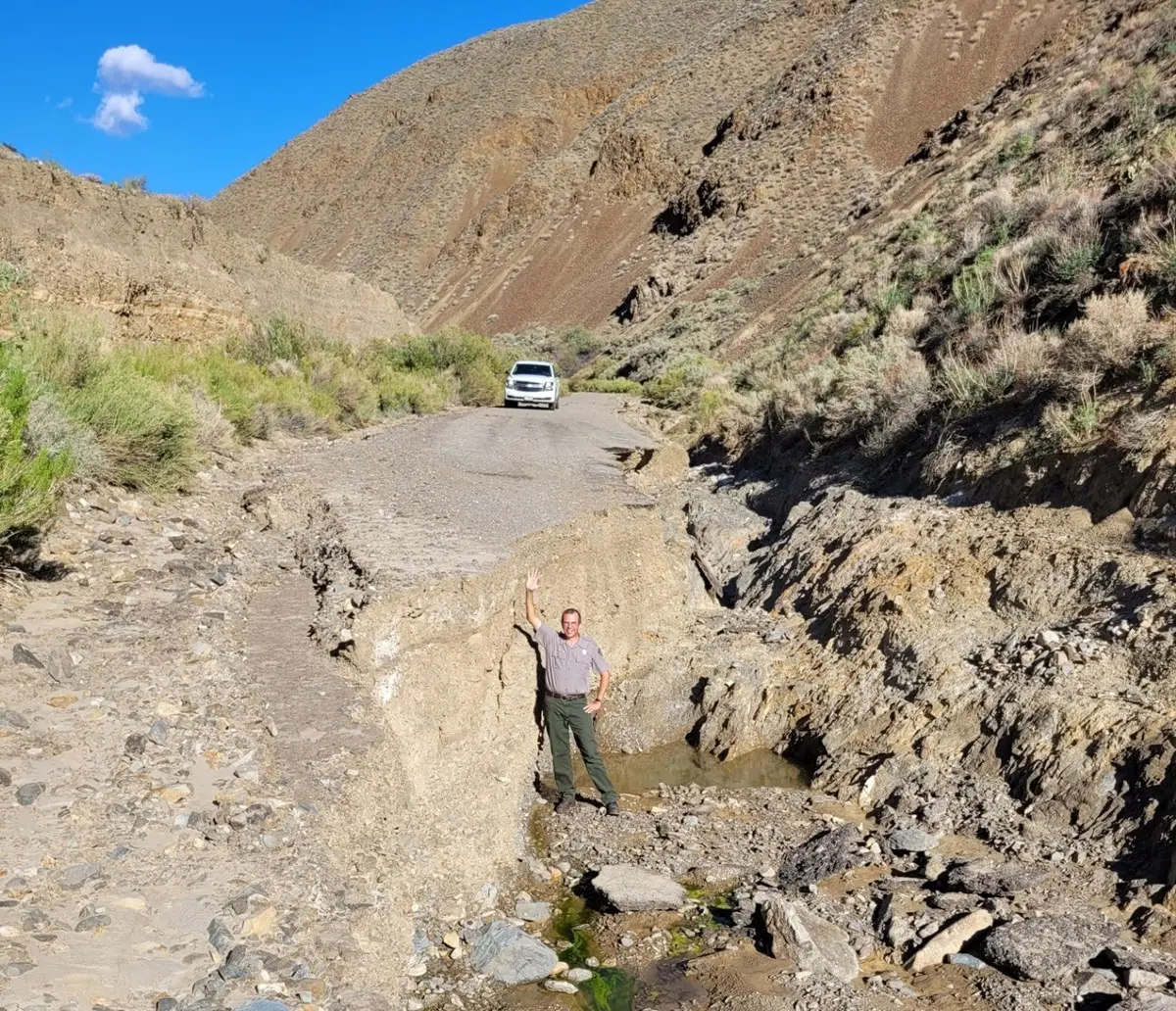
New rainfall has closed Beatty Cutoff Road and added fresh restrictions across Death Valley National Park. The National Park Service posted the danger alert on November 1 and updated its road list at 3:33 p.m. Pacific, warning that debris remains on paved routes and that crews may identify additional damage as assessments continue.
North Highway is no longer listed as closed, but motorists are told to watch for flood debris. Cottonwood and Marble roads are closed, Hunter Mountain Road is shut after muddy conditions stranded multiple vehicles, and Titus Canyon remains closed for earlier repairs. NPS is strongly discouraging travel on any unpaved road while the new storm impacts are evaluated.
The November storm builds on damage from October 22. Lower Wildrose Road remains open only with caution: vehicles longer than 25 feet are prohibited, and NPS says washouts and debris make the route unsuitable for low-clearance vehicles or street tires. Darwin Falls Road is missing in places and is expected to stay closed until summer 2027, while the Scotty's Castle area remains inaccessible during longer-term flood recovery.
This is an access disruption, not a park-wide shutdown. Furnace Creek, Stovepipe Wells, Mesquite Spring, Wildrose, Thorndike, Mahogany Flat, Eureka Dunes and Homestake campgrounds were listed as open on November 1. Emigrant Campground is closed for water-system repairs, Texas Springs and Sunset are in seasonal closure, and the lower pools at Saline Valley remain closed because of wildfire hazards.
What Travelers Need to Know
Check the official conditions page and interactive road map immediately before entering the park. Damage assessments are continuing, so a route listed here may change before arrival. Review Caltrans, Inyo County and Nevada transportation information separately for roads outside the park boundary.
Do not use a dirt road as an improvised detour. NPS is discouraging all unpaved-road travel during the current assessment, and GPS directions are unreliable in remote parts of Death Valley. Carry a current map, extra water, food and fuel, and download park information for offline use.
If the trip includes Lower Wildrose Road, use a vehicle shorter than 25 feet and confirm the route again with the park. Low-clearance vehicles and street tires are specifically discouraged. Turn around at barriers or deep mud rather than driving onto adjacent desert and creating new tracks.
Confirm the exact campground and approach road before departure. The park has no public transportation, cell service is absent on most roads, and help can be many hours away. Furnace Creek and Stovepipe Wells sell fuel around the clock; Panamint Springs fuel is limited to posted daytime and evening hours.
About the Location
Death Valley National Park spans eastern California and a portion of Nevada. Its below-sea-level basin sits beneath mountain ranges that rise thousands of feet above the valley floor, creating a landscape of salt flats, dunes, canyons and high-country roads across more than 3 million acres.
The park is the homeland of the Timbisha Shoshone and preserves layers of Indigenous, mining and transportation history. Its famously dry climate does not eliminate flood risk: NPS notes that occasional storms can produce flash floods, and those short events can damage long road segments in remote terrain.
Official sources
- Death Valley: official current conditions and October 22 flood closures
- Death Valley: official driving directions, entrances and remote-travel precautions
- Death Valley: official park overview and California-Nevada routing
- Death Valley: official weather and flash-flood background
- Death Valley: official cultural history