
STATE & NATION TRAVEL · alerts
Deep, swift water raises risk on Great Sand Dunes’ Medano Pass Road
By Bob LePage · Published October 26, 2026
The primitive road remains open, but Great Sand Dunes warns that crossings three through five have swift water as deep as 3 feet and that the remote route is unsuitable for AWD and 2WD vehicles.
Official announcement: National Park Service · October 23, 2026
Source: NPS October 23 Medano Pass road conditions and vehicle rules
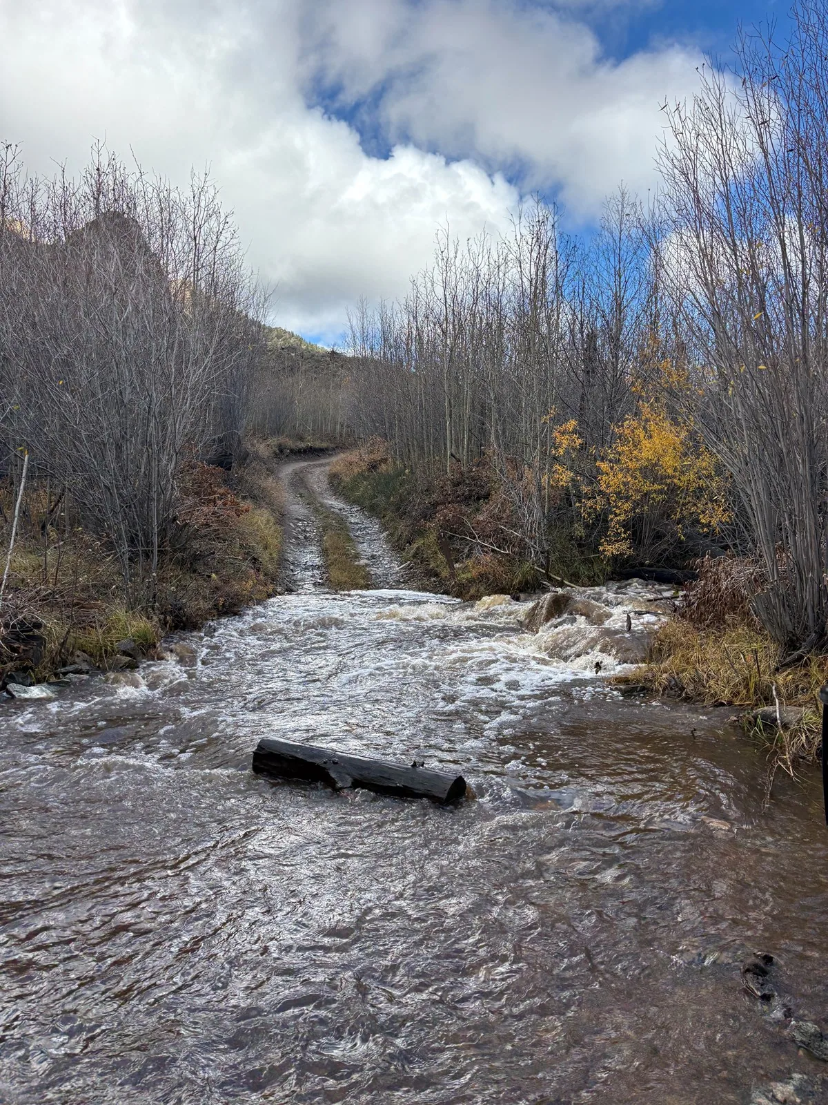
Great Sand Dunes National Park and Preserve is warning drivers about unusually deep, fast water on the Medano Pass Primitive Road after heavy rain. The route remained open in the park’s October 23 update, but the National Park Service said water at crossings three, four and five was moving swiftly and reached depths of up to 3 feet.
The warning applies to the remote primitive road, not the paved approaches to the visitor center, main dunes parking area or Piñon Flats Campground. On the same date, the park reported water at the main dunes area after 1.5 inches of overnight rain and said Medano Creek was flowing at Sand Pit and Castle Creek picnic areas. Those two picnic areas are beyond the paved road and require a qualifying high-clearance four-wheel-drive vehicle.
Conditions along the route extend beyond the creek. The park reported slippery mud near campsite 4.5 and between the eighth and ninth crossings, as well as mud and downed trees at campsite 4.5. Cell service is unavailable along the road, and the park cautions that emergency or law-enforcement response can be significantly delayed.
The legal vehicle restriction remains in force even though the road is open. Beyond Point of No Return, vehicles must have high clearance and true four-wheel drive with a low-range transfer case. All-wheel-drive and two-wheel-drive vehicles are prohibited. The park advises drivers to inspect each crossing before entering it and to turn around when the water, current or approach exceeds their vehicle or off-road experience.
What Travelers Need to Know
Use the paved State Highway 150 approach for the visitor center, main dunes parking and Piñon Flats Campground. Do not let a mapping app route an ordinary car over Medano Pass; NPS says the water warning does not block the paved destinations.
Do not drive beyond Point of No Return in an AWD crossover, 2WD vehicle, mini-SUV or other low-clearance vehicle. A legal setup requires high clearance, true 4WD and a low-range transfer case. Inspect every creek crossing on foot only when it is safe to do so, and turn around rather than testing a 3-foot crossing.
Check the Medano Pass road page immediately before departure and call the visitor center at 719-378-6395 for the latest conditions. Bring an offline route map, recovery equipment and a portable air compressor; the park’s public compressor was open in the October 23 update, but travelers should not depend on it.
Entrance passes are required, but the park does not require timed entry or an advance reservation for an ordinary visit. A camping plan does not override road conditions. Anyone using a primitive road campsite should verify that the route to it remains passable and should be prepared for mud, downed trees and delayed emergency response.
About the Location
Medano Pass Primitive Road runs 22 miles between the main Great Sand Dunes area and Colorado’s Wet Mountain Valley. The route crosses Medano Creek nine times, climbs to a 10,040-foot pass and takes about 2½ to 3 hours under normal conditions. It also reaches trailheads and designated campsites in the national preserve, so deep water can affect both a scenic drive and access to overnight or backcountry plans.
Great Sand Dunes lies in Colorado’s San Luis Valley, where the continent’s tallest dunes rise against the Sangre de Cristo Mountains. The area was first protected as a national monument in 1932 and was formally designated Great Sand Dunes National Park and Preserve in 2004. Its wind-and-water-driven dune system includes Medano Creek’s uncommon surge flow, which helps explain why a sudden autumn rise can change both the main visitor area and a rugged mountain road.