
STATE & NATION TRAVEL · news
Bryce Point gains paved-path access as October shuttle season nears its end
By Staff Writer · Published October 15, 2026
A completed 2.7-mile extension finishes the route between Bryce Point and Red Canyon. The park's 2026 shuttle schedule ends October 18.
Official announcement: National Park Service · October 15, 2026
Source: NPS announcement, October 15, 2026
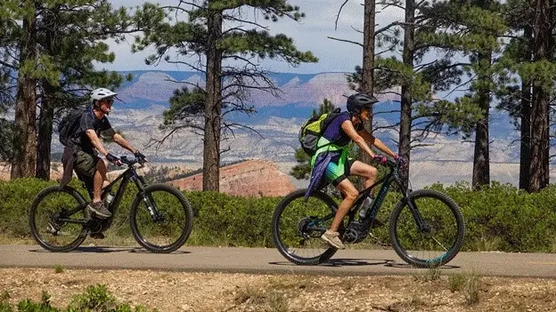
Travelers can now reach Bryce Point on the completed paved Shared Use Path rather than relying entirely on the park road. In an October 15 announcement, the National Park Service said the last 2.7 miles finished a 24-mile connection between Bryce Point in Bryce Canyon National Park and Red Canyon in Dixie National Forest. Work on that final section ran from May 2025 through September 2026.
The route, also called the Canyon2Canyon Trail, connects transportation with sightseeing. Within the park, its destinations include the visitor center, lodge, both campgrounds and the Sunrise, Sunset, Inspiration and Bryce viewpoints. NPS says the path accommodates people walking or cycling, wheelchair users and visitors with leashed pets, along with other listed uses. That does not extend bicycle access to the Rim Trail or to the overlooks themselves.
A one-way bicycle trip is an option while the shuttle is running: NPS describes a roughly seven-mile, mostly downhill ride from Bryce Point toward the visitor center and shuttle station. But the remaining shuttle-assisted window is short. The park's dated 2026 timetable lists October 18 as the final service day, with the current operating window shown as 8 a.m. to 6 p.m. The release's broader April-to-October description should not be read as a promise of buses through the end of the month.
What Travelers Need to Know
Check the official shuttle timetable and live tracker before planning a one-way ride, especially close to October 18. Each bus carries only two bicycles, so a rack space cannot be assumed. Use the stop-specific last-departure times rather than treating 6 p.m. as the final pickup at every stop. Shuttle rides are included with park admission; riders boarding outside the park must show an entrance receipt or qualifying pass. Consult the fees page for the admission rules applying to your party.
Keep bicycles on permitted paved routes. Use the bicycle racks and continue on foot when visiting overlooks; bikes are not allowed on the Rim Trail or the overlooks. A pet-friendly path does not mean a pet-friendly bus: the shuttle page says pets cannot ride. Check those differences before committing to a shuttle return.
The paved-path announcement does not reopen every hiking route. Active NPS alerts separately list Wall Street and the Bryce Connector Trail to Peekaboo Loop as closed until further notice. Review the park's current conditions and alerts before departure, and ask at the visitor center for the latest trail information rather than assuming neighboring routes share the new path's status.
For a winter visit, treat the release's skiing and snowshoeing possibilities as dependent on conditions, not as a guaranteed operating program or a shuttle extension. Recheck weather and access before choosing equipment or arranging a return trip.
About the Location
Bryce Canyon occupies the eastern side of the Paunsaugunt Plateau in south-central Utah. Its scenery is a sequence of amphitheaters cut into the plateau, rather than a single canyon. Frost and rain have helped shape the rock into narrow spires known as hoodoos, making the rim viewpoints an important part of a visit.
Federal protection began with a national monument in 1923; the park received its present Bryce Canyon name in 1928. The new link matters in that setting because it connects several ways of experiencing the same landscape: a paved approach between major stops, time on foot at the viewpoints and, during the operating season, a bus connection.