New Guinea fires drive unusually high emissions during drought
By Staff Writer · Published 10/22/2026, 2:19:00 AM ET
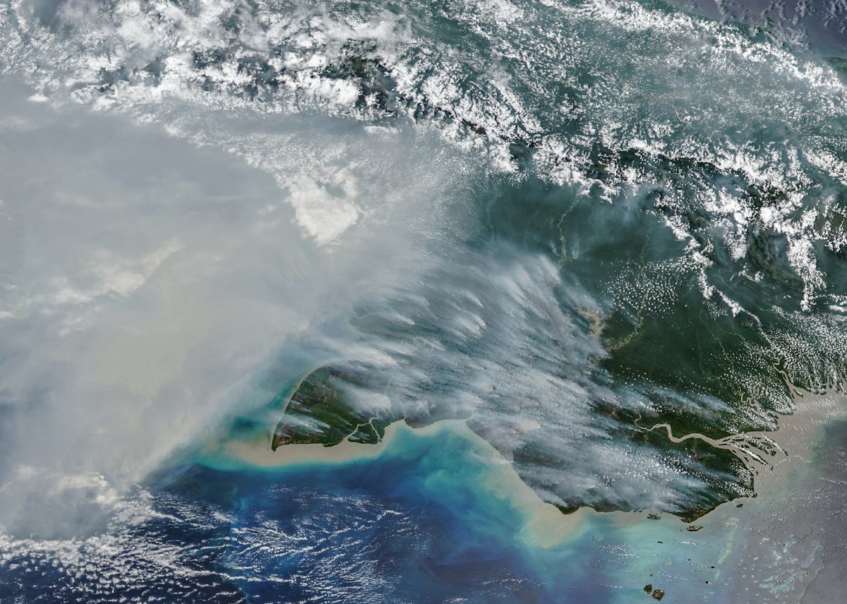
Smoke extends from southern New Guinea in this NOAA-20 VIIRS image acquired October 11, 2026, and published by NASA Earth Observatory on October 22.
NASA Earth Observatory / Michala Garrison. Data: NASA EOSDIS LANCE; GIBS/Worldview; Joint Polar Satellite System (JPSS); Global Fire Emissions Database (GFED). · Official image source · NASA media usage guidelinesNASA’s October 22 report pairs an October 11 satellite image with fire-emissions estimates, showing severe burning on both sides of the island.
Fire emissions in Papua New Guinea had reached nearly 32 megatons of carbon by October 19, exceeding the level recorded by that date in any previous year in the Global Fire Emissions Database, NASA Earth Observatory reported October 22.
The report describes extensive burning during September and October as drought associated with a strong El Niño dried the island. New Guinea is divided between Papua New Guinea in the east and Indonesian territory in the west; the emissions figures describe those areas separately.
For the Indonesian side, NASA reported emissions above 35 megatons of carbon, behind only 2015 and 1997 in the database’s record. These are estimates of carbon released by fires, not a count of fires or an estimate stated in carbon-dioxide units.
The database combines satellite observations with information about vegetation and other conditions to model burning and emissions. Its developer, Wageningen University & Research scientist Guido van der Werf, told NASA that Papua New Guinea could finish with its highest annual emissions on record. That remains a forecast rather than a completed annual result.
A NOAA-20 satellite image taken October 11 shows smoke spreading from southern New Guinea. NASA’s report says some smoke is carried upward or removed by thunderstorms, while smoke remaining close to the ground creates air-quality problems. NASA also reported flight cancellations and school closures linked to the smoke, without giving a comprehensive disruption count.
People start most fires in the region, researchers cited in the report said, including burns associated with farming, pasture management, hunting and land clearing. Dry conditions can allow those fires to escape control; the report does not identify the cause of every individual blaze.
Researchers quoted by NASA expect burning to continue until substantial wet-season rain arrives, usually in early November in southern New Guinea. The report does not establish that the rains have arrived or that the current fires are contained.
What it means
The satellite image documents smoke on one day, while the emissions estimates describe burning over a longer period. Together they indicate a severe fire season, but they do not establish a current local air-quality reading, the final annual emissions total or a guaranteed end date. The arrival of sustained rain is the next change identified by the researchers.
Source
This State & Nation summary is based on NASA Earth Observatory’s original release, dated 2026-10-22. The reporting above is attributed to the official sources linked here.